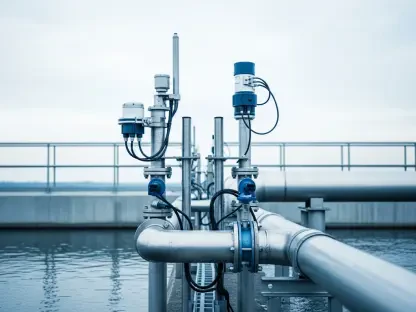

Beneath the familiar surfaces of our streets and sidewalks lies a complex, invisible world of vital infrastructure that presents a profound double-edged sword for modern society. For decades, municipalities and utility companies have wisely buried water mains, gas lines, fiber optic conduits, and power cables to enhance public safety, improve system reliability, and maintain community aesthetics. However, this protective layer of earth also creates a long-term challenge: once installed, these essential networks become practically invisible. Over time, the collective memory of their exact locations fades as paper records age, street layouts are rerouted, and even precise GPS coordinates lose their relevance with shifting surface landmarks. What was once a well-documented network transforms into a metaphorical minefield. When excavation crews begin to dig for maintenance, upgrades, or new construction, this invisibility can trigger disastrous consequences, ranging from disruptive service outages to catastrophic events like ruptured gas mains, severe flooding from damaged water lines, or widespread communication blackouts from severed fiber cables, all of which pose serious safety hazards and incur immense repair costs.
1. The Shortcomings of Conventional Locating Techniques
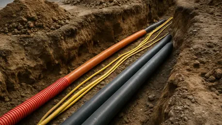
Historically, the ability to locate buried utilities has been heavily dependent on the presence of conductive materials, such as metal pipes, metallic conduits, or embedded tracer wires. Standard electromagnetic locating equipment operates by inducing and detecting a current that flows along these conductive paths, allowing operators to trace the utility’s route. This method proved adequate for older infrastructure but has become increasingly unreliable with modern materials. Since the 1970s, a significant portion of new installations, particularly for gas, water, and fiber optic networks, has utilized nonconductive materials like polyvinyl chloride (PVC) or high-density polyethylene (HDPE). These materials offer benefits in cost, durability, and corrosion resistance but are invisible to conventional locators, creating dangerous blind spots in subsurface surveys. The consequences of this technological gap are significant; independent blind trials have shown that standard survey methods can fail to identify as much as half of all subsurface utilities.
This uncertainty carries a steep price in both financial and human terms. Data reported by the Pipeline and Hazardous Materials Safety Administration (PHMSA) underscores the severity of the issue, revealing that gas utility pipeline incidents have resulted in an average annual cost exceeding $594 million over the past three years, accompanied by an average of 11 fatalities and 30 injuries each year. While more advanced and specialized technologies such as ground-penetrating radar (GPR) exist, they are not a universal solution. GPR systems can be prohibitively expensive, require extensive operator training to interpret complex data accurately, and their reliability can be significantly impacted by soil conditions, moisture content, and subsurface clutter. For many utility owners and contractors, these drawbacks mean that traditional locating methods remain a high-risk gamble, forcing them to operate with incomplete information and accept a dangerous level of uncertainty before every excavation.
2. A Contemporary Fix with Electronic Marker Systems
In response to the limitations of older methods, a modern and elegantly simple solution has emerged: the electronic marker system. This technology provides a direct and reliable way to pinpoint buried infrastructure, regardless of the material it is made from. The system works by burying a small, passive marker alongside the utility during installation. Each marker is precisely tuned to resonate at a specific frequency, which corresponds to a particular type of utility, such as gas, water, or telecommunications. When a crew needs to locate the line, a handheld detector is used to send a low-frequency radio signal, or “ping,” into the ground. If a marker is present, the signal causes it to resonate and emit a return signal, which the detector picks up, revealing the utility’s exact location and depth with remarkable accuracy. This direct-detection method eliminates the guesswork inherent in other techniques.
The key to the system’s long-term viability is the passive nature of the markers. They contain no batteries, fluids, or active electronic components that could degrade over time. Instead, they consist of a simple, sealed coil designed to remain stable and operational for decades, effectively matching the typical service life of the buried utility itself. Installation is a straightforward and low-cost addition to any construction project. For example, ball-style markers are weighted and self-leveling, ensuring their internal dipole is always oriented vertically for a maximum signal response, no matter how they are tossed into a trench. Alternatively, slim, pencil-shaped spike markers are ideal for shallow installations, placement inside narrow ducts, or marking points directly above assets installed via horizontal directional drilling. Because these markers are inexpensive and easy to deploy, they represent a minor upfront investment that delivers an enormous return in safety, efficiency, and long-term asset management.
3. The Key Advantages of Adopting Marker Technology
The widespread adoption of electronic marker systems provides a powerful suite of benefits that directly address the most critical challenges in subsurface utility management. Foremost among these is a dramatic enhancement in safety. By providing excavation crews with the precise location of buried lines before a single shovel breaks ground, markers virtually eliminate the risk of accidental utility strikes. This proactive approach prevents catastrophic failures such as gas leaks that could lead to explosions, water main breaks that cause flooding and soil erosion, or severed fiber optic cables that can disrupt essential communication networks for homes, businesses, and emergency services. This prevention of accidents translates directly into significant cost savings. The minimal expense of installing a marker is trivial when compared to the potentially millions of dollars required for emergency repairs, regulatory fines, litigation, and the indirect costs associated with project delays and service downtime.
Beyond the immediate crisis prevention, these systems fundamentally improve operational efficiency and simplify long-term planning. Knowing the exact location of a utility saves immense amounts of time that would otherwise be spent on speculative digging or searching for elusive lines, thereby keeping projects on schedule and under budget. This efficiency also minimizes public disruption by reducing the need for large excavations and prolonged road closures. Furthermore, markers are instrumental in creating and maintaining accurate, reliable digital maps of underground infrastructure. After an installation or repair, a technician can quickly read the marker’s location with a GPS-enabled locator and update the “as-installed” records in a geographic information system (GIS). This practice ensures that knowledge of the utility network is not lost over time but is instead preserved and refined, providing an invaluable resource for all future maintenance, system upgrades, and critical emergency response scenarios.
4. From a Gamble to a Guarantee
Ultimately, the decision to integrate electronic markers into utility installation practices represented a pivotal shift in how underground infrastructure was managed. For years, excavation projects had been fraught with uncertainty, where crews relied on aging, often hand-written records that were frequently misplaced or tied to surface landmarks that no longer existed. Digging under these conditions was a high-stakes gamble, a process where every scoop of dirt carried the potential to trigger a costly and dangerous accident. The work proceeded slowly and cautiously, with project timelines and budgets constantly threatened by the unknown variables hidden just below the surface. This environment turned essential infrastructure, a valuable societal treasure, into a significant liability. The very systems designed to support communities became a source of risk and unpredictability for those tasked with maintaining and expanding them.
With the introduction and implementation of a comprehensive marking system, that paradigm of risk was fundamentally altered. A job that once began with guesswork could now start with certainty. When a crew activated their locator, they were met with clear signals that painted a precise map of the utilities below, allowing them to plan their work with confidence and execute it with efficiency. There were no more surprises, no more accidental line strikes, and no more costly emergency repairs derailing the project. This transition demonstrated that hidden infrastructure did not have to be a liability; when properly identified and mapped, it could be managed as a secure and reliable asset. The lesson learned by forward-thinking utility owners and contractors was clear: to dig with confidence, one had to move from a reliance on fading memory to a guarantee of digital precision.