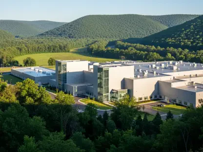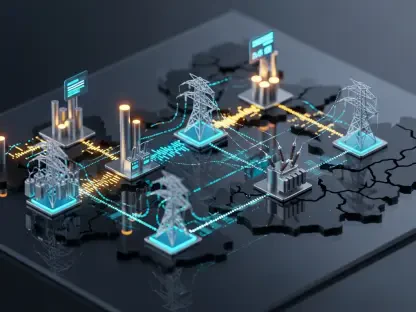

The logistical nightmare of identifying suitable land for massive renewable energy installations often stalls the global transition to clean power before a single solar panel or wind turbine is ever deployed. Historically, developers have relied on arduous manual surveys that could span several months and consume a staggering percentage of a project’s initial development budget, creating a bottleneck that the world can no longer afford. Singapore-based startup RIFFAI is fundamentally altering this landscape by deploying a sophisticated “command and control” platform that streamlines the site selection process. By integrating cutting-edge orbital technology with advanced machine learning, the firm allows energy companies to bypass the administrative and logistical delays that typically plague green initiatives at their inception. This evolution is not merely about speed; it represents a systemic shift toward a more data-driven and efficient approach to building the necessary infrastructure for a carbon-neutral society. As the inventory of easily accessible land continues to shrink, the necessity for high-precision, automated screening tools has transitioned from a luxury to an industry standard, ensuring that capital is deployed where it can generate the highest environmental and financial impact.
Advanced Geospatial Technology: Harnessing Multispectral Satellite Data
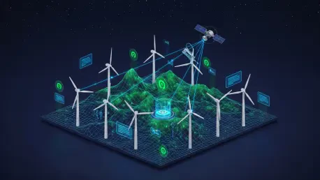
The core functionality of this platform is anchored in its capacity to aggregate and analyze hyper-multispectral imagery sourced from an extensive network of more than 50 satellite partners worldwide. Unlike standard optical photographs that capture only what is visible to the human eye, these advanced orbital sensors detect specific spectral signatures that provide deep insights into the physical characteristics of the Earth. This data allows for the identification of subtle soil compositions, moisture levels, and precise solar irradiance patterns that are critical for determining the long-term viability of a proposed energy site. By moving beyond simple visual assessments, the technology provides a layer of depth that traditional surveying methods simply cannot replicate within a reasonable timeframe. Developers can now visualize the thermal and mineralogical properties of a landscape from thousands of miles above, ensuring that the selected land is truly optimized for energy generation. This data-heavy approach significantly reduces the margin of error in early-stage planning, allowing for more confident investment decisions.
Processing this massive influx of information requires significant computational power, which is why the platform utilizes advanced artificial intelligence models trained on roughly 2.5 billion parameters. These models are specifically designed to transform raw, unstructured orbital data into a comprehensive and highly detailed map of terrestrial potential across entire continents. By automating the analysis of terrain slopes, wind patterns, and proximity to existing grid infrastructure, the system can identify viable project locations with unprecedented precision and speed. This capability allows developers to perform planetary-scale screening in just a few days, a task that would otherwise require dozens of specialized survey teams and several months of field research. As the availability of easily accessible land decreases, the ability to find hidden pockets of high-potential terrain becomes a competitive necessity. The AI acts as a filter, stripping away the noise of irrelevant data to present only the most feasible options for large-scale energy development, thereby accelerating the deployment of sustainable energy infrastructure globally.
Strategic Leadership: Navigating Regulatory and Environmental Risks
RIFFAI’s rapid rise within the renewable energy sector is inextricably linked to Singapore’s reputation as a premier global center for deep-tech innovation and sustainable development. Founded by Kolatat Katousano, a seasoned industry veteran with experience at Schneider Electric and The Crown Estate, the startup combines institutional expertise with the agility of a modern technology firm. This unique background provides the company with a deep understanding of the regulatory complexities and commercial realities that govern major infrastructure projects across diverse international regions. By operating out of a hub known for its stringent environmental standards and technological forwardness, the firm is well-positioned to bridge the gap between abstract satellite data and practical industrial application. The leadership team’s familiarity with large-scale land management and energy distribution ensures that the platform addresses the actual pain points faced by developers today. This strategic positioning allows the startup to scale its operations rapidly while maintaining the high standards required by global energy regulators.
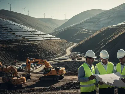
Beyond simple location mapping, the platform introduces a vital layer of scientific de-risking that protects the long-term interests of both investors and the environment. By employing unbiased machine learning algorithms to detect potential hazards such as hydrological instability or proximity to protected ecosystems, the technology identifies risks before they become costly liabilities. This proactive methodology ensures that the urgent push for carbon neutrality does not inadvertently cause local ecological damage or result in infrastructure failure due to unforeseen geological conditions. In many cases, traditional manual surveys may miss these subtle environmental indicators until construction has already begun, leading to significant delays and financial losses. The ability to forecast how a specific site will react to varying climate conditions over several decades provides a level of security that was previously unattainable in the energy sector. This rigorous analysis fosters a more sustainable approach to development where project success is measured by both financial returns and long-term ecological health.
Sustainable Growth: Achieving Long-Term Industrial Viability
The emergence of such platforms signals a transformative trend in global commerce where space-based data is becoming the invisible infrastructure supporting the industrial world. For decades, high-resolution satellite technology was the exclusive domain of national governments and military agencies, but it is now being democratized for practical industrial and commercial applications. This shift enables private energy companies and regional governments to access global oversight and data-driven decision-making capabilities that were once far beyond their reach. As satellite constellations grow more sophisticated and data costs continue to decrease, the integration of orbital intelligence into everyday business operations is becoming standard practice. This accessibility level allows for a more transparent and competitive market where developers can compete based on the quality of their data rather than just their size. The democratization of space data essentially levels the playing field, allowing smaller firms to identify and secure high-value energy sites with the same precision as major multinational corporations.
The successful integration of these advanced orbital tools into the energy sector established a definitive blueprint for how modern industry interacted with the natural world. Developers who moved away from antiquated, manual survey methods found that their projects were more resilient and significantly easier to finance due to the reduced risk profiles. The transition to data-driven site selection eventually encouraged a broader exploration of Earth observation, with technology models being adapted to monitor ocean health, agricultural output, and deforestation rates. It became clear that the most effective path toward global sustainability involved a commitment to continuous, high-precision monitoring of the planet’s diverse resources. Stakeholders recognized that investing in geospatial intelligence was not just a technical upgrade but a fundamental requirement for the responsible management of the environment. The lessons learned from the renewable energy surge solidified the role of AI as an essential partner in conservation and infrastructure development for years to come. This evolution ultimately proved that the marriage of space data and machine learning was the key to a more stable world.