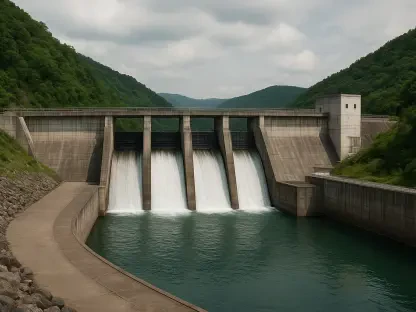

Agricultural water releases were forced to a halt in late July 2026 to prevent the total systemic collapse of the region’s primary irrigation infrastructure. This emergency maneuver became necessary when the water levels at Elephant Butte Reservoir plummeted to a historic low of 1.4% capacity, leaving the surrounding communities in a state of unprecedented uncertainty. For the first time in generations, the massive concrete structure, which once symbolized human dominance over the arid Southwest, stands as a stark reminder of environmental limits. The reservoir’s decline reflects a broader trend of aridification across the Rio Grande basin, where the traditional mechanisms of water delivery are no longer sufficient to meet the demands of a modern agricultural economy. As the basin enters this period of extreme scarcity, the immediate focus has shifted from managing abundance to rationing a finite and rapidly vanishing resource. This crisis necessitates a shift in how stakeholders perceive the relationship between climate and infrastructure.
The Historical Significance and Current Decline
Agricultural Legacy: The Rio Grande Oasis
Constructed in the early twentieth century, Elephant Butte Reservoir was heralded as an engineering masterpiece that would forever secure the future of agriculture in southern New Mexico and West Texas. For decades, it fulfilled this promise, transforming thousands of acres of Chihuahuan Desert into a lush corridor of pecan orchards, cotton fields, and the world-famous Hatch green chile farms. This green ribbon was so prominent that it served as a terrestrial landmark for early astronauts, providing a visual testament to the success of regional irrigation projects. The reservoir did more than just supply water; it created a cultural and economic identity rooted in the soil, supporting thousands of families and ensuring a steady supply of produce to the national market. However, the stability that characterized the latter half of the twentieth century has given way to a precarious reality, where the very crops that built the region’s wealth are now facing an existential threat from the lack of flow.
Current Depletion: Signs of Systemic Failure
The current hydrological collapse did not occur overnight but is rather the result of a persistent, multi-decadal drought that has systematically eroded the basin’s resilience. While the reservoir was nearly at full capacity as recently as the mid-1990s, the subsequent years have seen a steady and alarming decline, with a significant drop in 2013 that served as an early warning for the current catastrophe. Today, the physical landscape of Elephant Butte Lake State Park has been fundamentally altered, with boat ramps ending abruptly in dusty plains and the receding waters revealing long-submerged industrial debris and historical foundations. This exposure of the reservoir’s floor provides a haunting look at the past while highlighting the severity of the present situation. The exposed sediment and stranded infrastructure serve as a visceral reminder that the hydrological cycles of the past are no longer reliable, forcing a radical departure from the management strategies that were established.
Environmental Drivers and Socio-Economic Pressures
Climate Impact: The Disrupted Snowpack Cycle
The most critical environmental factor contributing to this crisis is the disruption of the southern Rocky Mountains’ snowpack, which has long functioned as a natural seasonal savings account for the region. Historically, winter snow would accumulate in the high altitudes and melt gradually throughout the spring, providing a controlled and predictable flow into the Rio Grande. In 2026, however, the region witnessed the earliest snowmelt in recorded history, a phenomenon that has become increasingly common as temperatures rise. When snow melts prematurely, the resulting runoff often arrives before the irrigation infrastructure is prepared to capture and store it effectively. This timing mismatch leads to significant water loss through unmanaged flow and increased evaporation from the reservoir’s surface, which is exacerbated by the intense heat of the desert sun. Consequently, the water that was intended for mid-summer irrigation is lost before the peak growing season even begins.
Regional Instability: Competition for Resources
The total depletion of surface water has forced a heavy reliance on groundwater pumping, creating a dangerous cycle that threatens the long-term health of regional aquifers. As farmers and municipalities drill deeper to compensate for the empty reservoir, the resulting pressure on underground resources has sparked intense legal and political friction between New Mexico and Texas. These disputes are governed by century-old interstate compacts that were never designed to accommodate the extreme scarcity currently being experienced. Beyond the human impact, the lack of consistent river flow poses a severe threat to the ecological preserves along the Rio Grande, which depend on specific water levels to maintain biodiversity and protect endangered species. The competition for every remaining drop has created a high-stakes environment where agricultural needs, municipal requirements, and environmental conservation are often in direct conflict, making a sustainable resolution difficult to achieve.
Technological Solutions and Future Adaptation
Precision Management: NASA’s Satellite Initiatives
In the face of this growing disaster, the integration of advanced technology has become a cornerstone of the regional survival strategy. NASA’s Western Water Action Office is currently working alongside New Mexico water managers to deploy satellite-based monitoring tools that provide a level of precision previously thought impossible. These researchers utilize high-fidelity data to monitor soil moisture levels and evapotranspiration rates across the entire irrigation district. By tracking how much moisture plants are releasing into the atmosphere, managers can determine exactly when and where water is most needed, allowing for surgical precision in allocation. This approach minimizes waste and ensures that every gallon released from the reservoir is utilized to its maximum potential. Furthermore, satellite water-surface height data is being paired with drone-based sensors to monitor the relationship between river flow and groundwater levels, providing a clearer picture of the basin’s health.
Future Resilience: Adapting to the New Normal
The shift toward data-driven governance offered a vital lifeline as the region navigated the harshest months of the 2026 water crisis. By utilizing NASA’s sophisticated modeling, the Elephant Butte Irrigation District successfully implemented real-time adjustments that prevented a complete collapse of the agricultural sector. However, the experience proved that long-term survival required more than just better tracking; it necessitated a fundamental shift in land use and crop selection. Stakeholders recognized that the era of water-intensive desert farming was no longer viable under the current climate trajectory and began incentivizing the transition to drought-resistant cultivars. These actions laid the groundwork for a more resilient management framework that prioritized aquifer recharge and modernized delivery systems. While the immediate crisis was managed through technological intervention, the focus moved toward permanent structural reforms that sought to balance human consumption with the reality of a shrinking Rio Grande.