
As the intensifying effects of climate change continue to disrupt traditional patterns of precipitation across the African continent, policymakers are increasingly turning their focus toward a massive subterranean reservoir that remains largely untapped. This “invisible” safety net, currently being meticulously mapped by the Groundwater for Advancing Resilience in Africa (G4R) project, represents a strategic buffer against the volatility of erratic rainfall and the severe evaporation losses seen in surface reservoirs. The sheer scale of this resource is almost unfathomable, with scientists estimating that roughly 0.66 million cubic kilometers of water lie hidden beneath the soil. To put this in perspective, this volume is nearly twenty times greater than the total amount of freshwater stored in all the continent’s visible lakes combined. For the 400 million people who currently live without access to basic drinking water, these deep aquifers are not just a geological curiosity but a vital lifeline for survival and growth.
Geological Diversity: Extraction Potential and Resource Limits
Part 1: The Finite Fossil Water of North Africa
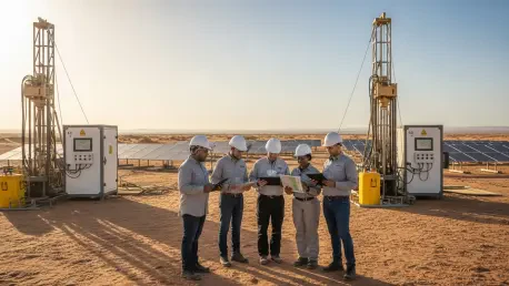
In the northern reaches of the continent, the geological landscape is dominated by massive sedimentary aquifers that have held water for millennia. Countries such as Libya and Egypt sit atop the Nubian Sandstone Aquifer System, where high-yielding boreholes provide the primary supply for both expanding urban centers and intensive industrial operations. These formations act like geological sponges, storing vast quantities of water within the microscopic pores of sedimentary rock. However, much of this resource is classified as “fossil water,” having been deposited during much wetter climatic periods over 10,000 years ago. Because the current arid climate does not allow for significant recharge, every liter extracted represents a permanent reduction in the total available supply. This creates a precarious situation where reliance on these reserves must be managed with extreme caution to avoid sudden depletion.
The physical consequences of over-extracting these non-renewable reserves extend beyond the mere loss of water. As the hydrostatic pressure within the sedimentary layers drops due to aggressive pumping, the overlying ground begins to lose its structural support. This often leads to land subsidence, a process where the earth physically sinks, potentially damaging surface infrastructure and permanently reducing the storage capacity of the aquifer itself. Scientists working with the mapping initiative emphasized the need for precise extraction limits to prevent these irreversible geological shifts. By modeling the relationship between porosity—the total volume of space within the rock—and specific yield—the amount of water that can actually be recovered—researchers provided national governments with the data necessary to transition from exploitative mining to a more balanced conservation-based approach.
Part 2: Renewable Resources in Crystalline Basement Rocks
In contrast to the thick sedimentary basins of the north, much of Sub-Saharan Africa is underlain by ancient crystalline basement rock. In these regions, water is not found within the rock itself, which is largely impermeable, but rather within a network of physical fractures and the weathered upper layer known as the saprolite. While these “cracked glass” formations generally offer lower flow rates compared to sedimentary aquifers, they possess a critical advantage: they are highly renewable. Because these shallow systems are physically connected to the surface, they are refilled during the annual rainy seasons. This makes them an ideal and permanent buffer for rural handpumps and small-scale irrigation projects, ensuring that local communities can maintain consistent water access even during the prolonged dry spells that characterize the region’s current climate.
Successful utilization of these crystalline aquifers requires a deep understanding of local geological fractures to ensure that wells are placed in high-yield zones. The mapping efforts focused on identifying the thickness of the weathered mantle, which dictates the total storage potential of the system. By pinpointing areas with high connectivity between fractures, the project enabled the development of resilient water points that resist seasonal drying. This decentralized approach empowered local communities to manage their own water security, reducing their vulnerability to the failure of large-scale surface water infrastructure. These basement rock systems proved to be a reliable cornerstone for rural development, providing a steady supply of high-quality water that supported both domestic needs and the livestock that form the economic backbone of many Sub-Saharan African villages.
Strategic Implementation: Human Impact and Global Governance
Part 1: Mapping Human Needs and Pollution Risks
The integration of complex geological data with human demographic statistics allowed the G4R project to identify specific “hotspots” where groundwater can provide the highest humanitarian return on investment. For instance, researchers identified roughly 94 million rural residents in nations like South Sudan and the Democratic Republic of the Congo who live directly above accessible, safe drinking water reserves. Beyond immediate survival, the mapping data highlighted zones suitable for sustainable irrigation that could support over 300 million people. By opening these areas to small-scale farming, the continent moved closer to achieving widespread food security. This demographic targeting ensured that financial resources were directed toward the regions where the subterranean water could most effectively break the cycle of poverty and climate-induced migration.
While the quantity of groundwater is significant, the mapping initiative also addressed the mounting threat of subterranean pollution. Currently, over 500 million people live in areas where human activity and rapid urbanization pose a direct risk to aquifer quality. Contaminants from unlined pit latrines, agricultural runoff, and industrial waste can slowly seep into the ground, turning a vital resource into a public health hazard. To mitigate this risk, the project established rigorous monitoring protocols and “vulnerability maps” that identified which aquifers were most susceptible to surface contamination. This preventative data allowed town planners to establish protection zones around communal wells and directed the construction of safer sanitation infrastructure. This proactive stance ensured that the expansion of water access did not inadvertently lead to widespread waterborne illness or long-term environmental degradation.
Part 2: Cooperative Governance and Sustainable Frameworks
Effective groundwater management often requires navigating complex political landscapes, as many of the largest aquifers cross international borders. To prevent diplomatic tension and ensure the equitable distribution of resources, the project emphasized transboundary cooperation through shared scientific initiatives. In the Mono and Shire River basins, neighboring nations like Togo, Benin, Malawi, and Mozambique participated in joint “hydro-censuses” and the deployment of real-time monitoring technology. These shared sensors tracked water levels and salinity, providing all parties with a transparent and objective dataset. By establishing a common technical language, these countries were able to negotiate water-sharing agreements based on empirical evidence rather than political posturing, fostering regional stability and ensuring that no single nation depleted a shared resource at the expense of its neighbors.
The successful implementation of these scientific endeavors shifted the continent from a reactive mode of water management to a proactive, data-driven framework for long-term resilience. Stakeholders across Africa established permanent monitoring networks and integrated groundwater data into their national climate adaptation strategies. They invested in modern drilling technologies and localized maintenance programs that ensured the longevity of new infrastructure. By providing digital transparency for a hidden asset, researchers enabled regional leaders to secure funding for sustainable water projects that prioritized the needs of the most vulnerable populations. This comprehensive approach transformed the vast underground reserves into a manageable foundation for economic growth, proving that scientific insight, when paired with international cooperation, could effectively mitigate the most severe impacts of a volatile and changing global environment.