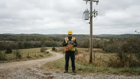

Field crews can now access and update geospatial data in disconnected environments using specialized mobile tools that synchronize automatically once reconnected. This technological advancement represents a massive leap forward from the legacy systems that previously hampered utility operations during severe weather events. For Duquesne Light Company (DLC), the journey toward this digital ecosystem began as a response to a critical failure in 2015, when a severe windstorm led to the loss of handwritten damage assessment folders. That single point of failure demonstrated that paper-based workflows were insufficient for a utility serving 600,000 customers in southwestern Pennsylvania. The inability to track real-time progress left crews idle and delayed power restoration, serving as a permanent catalyst for organizational change. Fast forward to the present day in 2026, and the company has successfully transitioned into a data-driven leader capable of managing complex grid environments with surgical precision. During a major windstorm in March of this year, DLC utilized its integrated digital suite to restore power to 95 percent of the 165,000 affected customers in just 48 hours. By moving away from manual record-keeping, the utility has not only improved its emergency response but has also laid the foundation for a resilient, modern energy network.
Building a Modern Grid Foundation
Creating the Digital Connectivity Model
For over a century, the physical infrastructure of the electrical grid was managed through static maps and institutional knowledge, but the rise of modern energy demands required a more sophisticated approach. Duquesne Light Company recognized that to support the integration of electric vehicles, residential solar panels, and microgrids, it needed a comprehensive digital connectivity model. This model serves as a live map of the entire network, detailing how electricity flows from substations through transformers and eventually to individual meters. Without this high-accuracy data foundation, performing “circuit tracing” to identify the origin of a fault was a labor-intensive process prone to human error. Now, the digital model allows engineers and dispatchers to visualize the electrical path in real time, significantly reducing the time required to diagnose system failures. This shift from physical asset tracking to digital flow modeling has become the primary driver of operational efficiency across the company’s service territory.
The urgency of building this digital foundation was also spurred by the increasing volume of solar interconnection requests. In the early 2010s, manual regulatory approval processes were at risk of being overwhelmed by the sheer number of customers wanting to contribute back to the grid. By digitizing the network, DLC can now automatically assess the impact of new energy resources on local circuits, ensuring that the grid remains stable as it becomes more decentralized. This connectivity model does more than just show where equipment is located; it provides a predictive framework that allows staff to understand exactly which customers will lose power if a specific breaker or switch fails. This level of granular detail is essential for managing the modern “prosumer” landscape, where customers are both consumers and producers of energy. The digital twin of the physical grid ensures that the utility can adapt to shifting load patterns without compromising the reliability that the city of Pittsburgh and its surrounding communities depend on.
Navigating the Human Element of Transition
While the software implementation was a significant technical achievement, the success of the project depended heavily on managing the human element of change. A four-year undertaking of this magnitude required seamless coordination between the information technology, engineering, mobile operations, and customer service departments. To mitigate resistance from staff who were used to decades of paper-based workflows, DLC focused on “mapping workflow changes.” This strategy involved showing employees exactly how their familiar daily tasks would translate into the new digital environment, rather than simply imposing new software on them. By demonstrating that digital tools would make their jobs safer and more efficient, the organization was able to secure buy-in from the ground up. This cultural alignment proved to be just as important as the code itself, as it ensured that the new tools were fully utilized rather than bypassed in favor of old habits.
To further bridge the gap between legacy processes and modern technology, the GIS team embarked on an 18-month “listening tour” that included on-site office hours and roadshows. This initiative reached over 800 users across the company, providing a platform for field crews and office staff to offer direct feedback on the software’s configuration. By listening to the specific challenges faced by investigators and dispatchers, the utility was able to tailor the interface to meet actual operational needs. The company also prioritized the use of commercial off-the-shelf capabilities, which minimized the need for expensive, difficult-to-maintain customizations. This inclusive approach turned what could have been a disruptive technological shift into a shared organizational success. It empowered employees to take ownership of the digital transition, fostering a sense of pride in the company’s move toward a more technologically advanced future.
Leveraging Advanced Technological Pillars
Integrating Esri and Schneider Electric Tools
The technical backbone of this transformation is built on the powerful integration of Esri’s ArcGIS Utility Network and Schneider Electric’s EcoStruxure ArcFM. The ArcGIS Utility Network provides a sophisticated platform for modeling complex infrastructure, allowing for advanced network tracing and real-time connectivity analysis. This allows office-based engineers to run simulations and visualize how a failure in one part of the system might cascade through the rest of the grid. By having a unified geospatial view, the utility can manage the entire life cycle of an asset, from planning and construction to maintenance and eventual decommissioning. This platform provides the necessary scalability to handle the vast amount of data generated by modern smart meters and grid sensors, turning raw information into actionable operational intelligence that can be used to improve service reliability across the region.
Complementing the geospatial foundation, the EcoStruxure ArcFM suite adds utility-specific workflows and automation tools that streamline data management. For example, ArcFM Pro acts as a specialized plug-in that automates complex approval processes, ensuring that asset information remains accurate as it moves between departments. Another key component, the Session Manager, maintains data integrity by controlling how and when edits are made to the network map. This prevents conflicting updates and ensures that every department is looking at a “single version of the truth.” By bridging the traditional divide between geographic information systems and operational technology, these tools have created a cohesive digital environment. This integration allows dispatchers to see the exact state of the grid at any moment, facilitating faster decision-making during both routine maintenance and large-scale emergency events.
Equipping Field Crews and Office Staff
Ensuring that high-quality data is accessible to everyone in the organization required the deployment of specialized applications designed for different working environments. For office staff and dispatchers, browser-based tools like ArcFM Web allow them to interact with the GIS data and run network traces without needing specialized desktop software. This accessibility means that information is no longer siloed within the engineering department; instead, it is available to any authorized employee who needs it to make informed decisions. During major outages, this shared visibility allows the communications team to provide more accurate updates to the public, while customer service representatives can give callers precise information about restoration progress. This transparency has significantly improved customer satisfaction by reducing the uncertainty often associated with power interruptions.
For those working outside the office, the deployment of ArcFM Mobile has been a game-changer for field efficiency. Investigators and repair crews can now view the entire connectivity model on their mobile devices, even when they are working in remote areas or locations with poor cellular reception. They can mark damage, update the status of repairs, and document equipment changes directly in the field. Once the device regains a connection, these updates are automatically synchronized with the central database, providing the dispatch center with instantaneous progress reports. This eliminates the need for crews to return to the office to submit paper reports or for data entry clerks to manually transcribe handwritten notes. The result is a much faster feedback loop that keeps the entire organization synchronized, ensuring that resources are always directed to where they are needed most.
Enhancing Storm Response and Restoration
Automating Outage Triage and Dispatching
The most dramatic improvements resulting from the digital transition are seen during the high-stakes environment of storm restoration. When an outage occurs, the digital connectivity model feeds real-time data directly into the company’s outage management system. This integration allows the system to work backward from customer reports and smart meter data to identify the specific piece of equipment that has failed. Rather than dispatching multiple crews to various individual addresses, the system can now group hundreds of customer calls under a single “root cause” failure. This automation allows dispatchers to send a single crew to the exact transformer or switch responsible for the problem, restoring power to an entire neighborhood in one action. This targeted approach has drastically reduced the “windshield time” crews spend searching for faults, allowing them to focus entirely on repair work.
During the massive wind event in March 2026, this automated triage process proved its value by managing approximately 2,500 individual trouble tickets with minimal manual intervention. The system analyzed the incoming data and immediately identified the most efficient restoration path, preventing the gridlock that often occurs when utilities rely on manual dispatching methods. By organizing work orders based on the electrical hierarchy of the grid, the company was able to resolve large-scale issues first, which naturally brought the greatest number of customers back online in the shortest possible time. This level of operational intelligence was previously impossible under the old paper-dependent regime, where managers had to wait hours for physical reports to be returned from the field. Now, the status of every repair is visible on a digital dashboard, providing a real-time pulse of the restoration effort.
Prioritizing Critical Infrastructure During Emergencies
In addition to general restoration efficiency, the new digital tools allow for the automatic prioritization of critical community infrastructure. During a crisis, the system is programmed to flag facilities such as hospitals, water treatment plants, and emergency response centers, moving them to the top of the restoration queue without requiring a dispatcher to intervene manually. This ensures that the most vital services are restored first, protecting public health and safety during prolonged outages. Furthermore, dispatchers can use geospatial grouping features to identify multiple repair tasks located within the same geographic cluster. This allows them to assign a single team to resolve several issues in one neighborhood in a single trip, rather than having different crews crisscrossing the city. This localized strategy further accelerates the pace of recovery and reduces overall operational costs.
The use of an interactive outage map has also transformed how the company interacts with its customers during these events. By providing real-time data on the location of repair crews and offering accurate estimated times of restoration, the utility has empowered its customers with information. This self-service transparency reduces the volume of calls to the emergency center, allowing staff to focus on managing the actual restoration rather than answering repetitive questions. Customers can now track the progress of their specific outage and see when a crew has been assigned to their area. This modern approach to communication builds trust and demonstrates the utility’s commitment to transparency. By leveraging digital tools to manage both the physical repair work and the flow of information, Duquesne Light Company has set a new standard for emergency management in the utility industry.
Achieving Long-Term Operational Excellence
Maintaining Data Integrity and Load Balance
Beyond the immediate benefits of storm restoration, the digital transition has provided long-term advantages for daily grid maintenance and data accuracy. The implementation of the ArcFM Validation Assistant has been particularly effective, using plain-language prompts to help staff identify and correct data errors before they can cause operational issues. For instance, the system can flag if a meter is incorrectly linked to a transformer or if an asset’s attributes are inconsistent with its location. This focus on data quality has resulted in 99 percent accuracy in identifying the relationship between transformers and customer meters. Such precision is vital for load balancing, which ensures that electrical demand is evenly distributed across the grid. Proper load management prevents equipment from overheating and failing prematurely, which extends the life of the utility’s physical assets and reduces the need for expensive emergency replacements.
Maintaining high-quality geospatial data also supports more efficient routine maintenance and enhances the utility’s ability to detect energy theft or equipment tampering. When asset data is accurate, maintenance crews can be routed more effectively for inspections, reducing fuel consumption and labor costs. This proactive approach to grid management allows the company to identify potential vulnerabilities before they lead to service interruptions. The transition to a digital connectivity model has effectively moved Duquesne Light Company from a reactive maintenance posture to a proactive, data-driven strategy. By ensuring that every pole, wire, and transformer is accurately represented in the digital twin, the utility can optimize its long-term capital investments and ensure that the grid remains capable of meeting the evolving needs of the region’s 600,000 customers.
Transforming Future Grid Operations
The successful implementation of these digital tools demonstrated that legacy utilities could modernize their operations without sacrificing reliability. By integrating geospatial intelligence with real-time operational data, Duquesne Light Company established a flexible infrastructure that was prepared for the complexities of the modern energy era. This transformation proved that the key to navigating such a massive shift was a disciplined strategy that balanced technological adoption with comprehensive human training. Organizations looking to follow this path should prioritize the creation of a high-accuracy connectivity model and invest heavily in change management to ensure the workforce is ready to embrace new workflows. As the grid continues to evolve toward decentralized energy resources and increased electrification, having a robust digital foundation will be the defining factor in a utility’s ability to provide safe and reliable service.
Future steps for utilities should include expanding digital models to transmission and substation facilities to create a truly end-to-end view of the electrical system. Duquesne Light Company already moved toward this goal, ensuring that every level of the network benefited from the same geospatial precision. Decision-makers must realize that digital transformation is not a one-time project but an ongoing commitment to data integrity and operational agility. By leveraging automated validation tools and mobile synchronization, utilities can maintain a high level of accuracy that supports both daily operations and large-scale emergency responses. The transition in Pittsburgh served as a powerful model, showing that when technology and human expertise are aligned, the result is a more resilient grid and a more satisfied customer base. The age of paper-based utility management ended, replaced by an era of real-time intelligence and proactive grid management.